
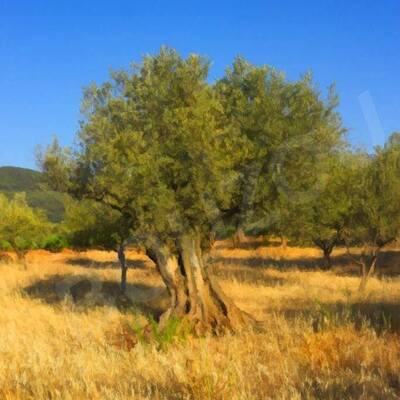
See The Mississippi River’s Hidden History, Uncovered By Lasers
Using hyperprecise LiDAR data,. a cartographer [well, hydrographer!] maps the river’s bend and channels over time with mesmerizing results…
--
https://www.nationalgeographic.com/science/article/mississippi-rivers-hidden-history-uncovered-by-lidar <-- shared technical / media article
--
https://dancoecarto.com/ <-- shared @Daniel Coe portfolio and more
--
https://usace.contentdm.oclc.org/digital/collection/p266001coll1/id/10015/ <-- shared Harold Fisk's 1944 USACE report, “The Alluvial Valley of the Lower Mississippi River”
--
#GIS #spatial #mapping #water #hydrography #hydrology #LiDAR #remotesensing #spatialanalysis #spatiotemporal #hydrogeomorphology #Mississippi #River #Fiske #cartography #visualisation #meandering #channels #landforms #floodplains #opendata #3DEP #topography #geomorphology #levees #dikes #oxbows #channel #paleohydrology
#DanielCoe | @nationalgeographic | #USGS | #USACE
#dikes


#HobbyStreak day 1084:
Took fellow #history nerd Bob past many #Frisian #churches, dwelling mounds (or #terps ), and #dikes and pointed out the ages of the churches by the bricks used because I'm a ducking freak like that.
Also took him to #starfortress #citadel #bourtange which happened to have a #fantasy fair, which means lots of overpriced ooh aah tat.


Port Saint-Pierre Lighthouse
Hyères, French Riviera
#photography #blackandwhitephotography #seascapephotography #hyeres #france #photos #jlbouzou #lifgthouse #mediterranean #frenchriviera #sea #dikes

Did a 5km walk with the girls that's as (northern) Dutch as you can get them. Nearly the edge of the world.
Was not a #SilentSunday because of a stiff breeze 😂
#Waddensea #waadsee #wattenmeer #waadsee #dikes #dijklandschap #sea #nature
Stormy weather. We went for a short walk between two rain showers and got this beautiful light.
Have a nice Sunday evening.
#sunday #sundayvibes #SilentSunday #dijken #dikes #Deiche

Cenozoic Exhumation Across The High Plains Of Southeastern Colorado From (U-Th)/He Thermochronology
--
https://doi.org/10.2113/2023/lithosphere_2023_310 <-- shared paper
--
[as a geologist and an adventure rider – and a Colorado resident that loves history - I have travelled all over this area; first photo is mine, my motorcycle under the Apishapa Arch in Aguilar, Colorado, a 1930s Civilian Conservation Corps project through a volcanic dyke, ‘coincidentally’ providing better access to land that a senator had purchased up around Cuchara and Cordova Passes]
#GIS #spatial #mapping #geology #Colorado #structuralgeology #Cenozoic #Thermochronology #model #modeling #3dmodeling #HighPlains #RockyMountains #Tertiary #intrusives #volcanics #vulcanism #SpanishPeaks #ApishapaArch #dates #dating #erosions #peneplanation #dikes #dykes
![Schematic [geologic] cross-section of Cenozoic exhumation in the High Plains from the Spanish Peaks (A - west) to Two Buttes (A’ - east).](https://files.mastodon.social/cache/media_attachments/files/112/287/764/207/513/294/original/7e906f8eac74beda.jpeg)


![[as a geologist and an adventure rider – and a Colorado resident that loves history - I have travelled all over this area; this photo is mine, my motorcycle under the Apishapa Arch in Aguilar, Colorado, a 1930s Civilian Conservation Corps project through a volcanic dyke, ‘coincidentally’ providing better access to land that a senator had purchased up around Cuchara and Cordova Passes]](https://files.mastodon.social/cache/media_attachments/files/112/287/764/428/090/023/original/a318fc1e9c88228b.jpg)

This time a story that has nothing new for me...
but maybe for NON Dutch readers.
About dikes.
"Uncovering the hidden dangers within dikes"
door Frances Kannekens voor Next Blue
https://www.next.blue/uncovering-the-hidden-dangers-within-dikes/
Quote:
"Mostly built of earth, with a vegetation cover on top, the dikes attract animals, especially the burrowing kind. These animals dig tunnels, holes and shelters to live in. While they make a safe home for themselves, their homes pose a significant threat to the dikes."
"For their concluding assignment, students assumed the roles of crisis coordination experts, specifically simulating the responsibilities of dijkgraafs or dike wardens. Their task involved addressing the imminent collapse risk of a damaged dike, compromised by animal burrows."
"While the students had to manage a pretend-crisis, the actual monitoring is done by watchful wardens who navigate the dike through stages – from assessment to emergencies."

Above and upon #igneous #dikes
The feature sure looked like a #dike on #satellite view, and a ground check confirmed it. Probably a late #Triassic or early #Jurassic intrusion into #Proterozoic Dedham #Granite, as #Pangea rifted. At Black Rock #Beach, #Hingham, #Massachusetts, #NewEngland #geology USA.
Satellite view from #AppleMaps, #photo by me.

It made headlines recently, the fact that New York city is sinking. It is because of all the massive amount of weight contained in all those high buildings. But various parts of the city are sinking at different rates.
Counter intuitively, all those highest buildings aren’t sinking at all. Why? Because they go down to the bedrock. And so far, bedrock hasn’t been found to sink at all.
Still, Parts of Manhattan and the other boroughs are sinking by between 1 and 4 mm a year. This, combined with the rising of sea levels mean that eventually these parts will be beneath the waves.
Could this possibly mean there was an Atlantis with incredibly high and heavy buildings that already sunk beneath the waves? It’s a possibility. However, I doubt the world could support a continent sized city with massive skyscrapers all over. Still, maybe Atlantis was only an island. If the island had no bedrock, with skyscrapers it could easily have slipped beneath the waves.
But Atlantis is so depressing. Why couldn’t there be a continent that rose above the waves?
There kind of is an Anti-Atlantis. The lands reclaimed from the ocean in the Netherlands are a kind of Anti-Atlantis. The idea is simple enough. Build dikes higher than the water that completely contain an area, then pump out the water and keep pumping through any rainfall. What you get is fully reclaimed land from the sea. For centuries the unceasing pumping was done with windmills which made that an iconic symbol of the Netherlands.
I did wonder what kind of crops can grow on land that has been in the briny deep. Lands with salt tend to be infertile, but not to all crops. Just by growing salt tolerant crops, in a couple decades or so, most of the salt will be out of the soil, and more normal crops will be able to be grown in that soil.
So, as long as the Dutch don’t decide to build skyscrapers on their reclaimed land, they have successfully pulled off the Anti- Atlantis trick.
#anti-atlantis #atlanits-story-is-depressing #atlantis #bedrock #continent #dikes #dutch #island #land-with-salt-mostly-infertile #manhattan #massive-amount-of-weight #netherlands #new-york-city #skyscrapers #some-salt-resistant-crops #windmills
https://larryrusswurm.com/2023/06/24/beneath-the-waves-above-the-waves/

In many places today, #dikes are being moved back, and #floodplains are being revitalized in order to give the #river more space during times of #flooding. This should make flood protection more effective and reduce the risk of flooding in #inhabited areas. Nevertheless, natural flood prevention projects are often met with considerable resistance from the general population.
#Environmental #SocialScience #sflorg
https://www.sflorg.com/2023/04/en04172302.html

Find out the whole story at:
https://www.worldwideglobalnews.com/
#humor, #funny, #satire, #Dutch #Dikes


It's rainy and dreary behind the dikes. Some colors from this morning. Have a lovely evening 💫
Natte zooi achter de dijken. Nog wat kleur van vanochtend. Fijne avond alvast🌙
This mornings #Sunrise #LandscapePhotography #ThursdayVibes #Fog #Trees #Skies #TheNetherlands #Dutch #Mastodonderdag #Dikes #GoodEvening

#EDITORIAL: #Canada’s failing #public #infrastructure | Toronto Sun
Long before #climateChange became a buzzword, #federal, #provincial and #municipal #governments failed to ensure that publicly-financed #projects such as #roads, #highways, #bridges, #publicTransit, #dikes, #water and #sewer mains, #hospitals and other #publicInfrastructure were properly maintained after they were built.
https://torontosun.com/opinion/editorials/editorial-canadas-failing-public-infrastructure