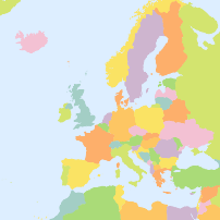
Slightly rude..? --
It's not hard:
Prefer traditional? -- #Shapefile is your best bet 👍
Into #cloudnative and MDS etc? -- Go with Cloud-Optimized Shapefile #CoSHP ✌️
Also: I *made* quite some careers 😊 #gischat
Slightly rude..? --
It's not hard:
Prefer traditional? -- #Shapefile is your best bet 👍
Into #cloudnative and MDS etc? -- Go with Cloud-Optimized Shapefile #CoSHP ✌️
Also: I *made* quite some careers 😊 #gischat

✨ Le plan cadastral millésime décembre 2025 est disponible !
Formats disponibles : #DXF / #EDIGEO (DGFiP) · #GeoJSON · #Shapefile · Tuiles vectorielles #MBTiles · #Geoparquet
🆕 À retenir :
🔹 des mises à jour trimestrielles (mars, juin, septembre, décembre)
🔹 des données plus lisibles et cohérentes dans le temps
🔹 une publication après consolidation et traitement, pour garantir la qualité

#viewinline: A new no-fuss way to visualize your vector data and rasters right in the #terminal: viewinline is a lightweight #Python utility by @Keiko_geo that renders #GeoTIFF-s, #GeoPackage-s, #GeoJSON-s, and #Shapefile-s instantly in #iterm2 (and other compatible terminals).
https://spatialists.ch/posts/2025/11/04-viewinline/ #GIS #GISchat #geospatial #SwissGIS
Geo Cloud Converter: Maphub.co launches #GeoCloudConverter, a browser-based #WASM tool that transforms common geospatial file types — #GeoJSON, #Shapefile, #KML, #GPX, CSV, #GeoPackage, or #GeoTIFF – into modern, #cloudnative formats like #GeoParquet, #FlatGeobuf,...
https://spatialists.ch/posts/2025/10/28-geo-cloud-converter/ #GIS #GISchat #geospatial #SwissGIS
Assassination Coordinates #etc #video #sanfrancisco #shapefile #animation Animation that zooms from a global map to the streets of San Francisco using five different shapefiles.
https://fed.brid.gy/r/https://ithoughthecamewithyou.com/post/assassination-coordinates
For GIS Nerds only: The ShapeFile Song https://geoobserver.de/2025/06/27/for-gis-nerds-only-the-shapefile-song/ #shapefile #song #gistribe #gischat #fossgis #foss4g #OSGeo #spatial #geospatial #gis #geo #geoObserver pls RT

Je tente ma chance : quelqu'un sait où et comment me procurer en carte géoréférencée (si possible en shapefile) des départements français en 1848 (ou en tout cas avant 1860)?
Je cherche à faire des cartes sur QGIS pour ma thèse mais je me heurte un peu aux absences de données historiques utilisables. J'ai moyennement envie de tracer des polygones moi-même...
Still Shapefile Like It’s 1999?
Nostalgia’s great but cutting-edge technology’s better.
#esri #shapefile #FuruhashiLab #古橋研究室 #AoyamaGSC #青学 #GEOlab #PoliMI

@aboutgeo Went with clusters in the pmtiles in the end. Here are the gory details: https://github.com/healthyregions/overture-poi-extract/blob/v0.0.1/extract_pois.py#L142 Ultimately, we needed to create #geojson #pmtiles or #shapefile extracts from the #overturemaps "places" theme for groups of categories, filtered just to the US. But I built it so random geoms can be passed in, or you can just provide a state, county, tract, etc. ID and that boundary will be used as a filter.
[📂Utiliser des données en #opendata n°6] Vous avez téléchargé des données et souhaitez ouvrir le fichier.
L'équipe de data.gouv.fr propose un rappel de quelques options possibles pour les formats #CSV, #JSON, #XML, #GeoJSON, #shapefile et #KML dans son guide : https://guides.data.gouv.fr/reutiliser-des-donnees/guide-traitement-et-analyse-de-donnees/manipuler-des-donnees/ouvrir-des-donnees

Friends don't let friends save geodata as #shapefile ✅
(http://switchfromshapefile.org)
On a related note:
A friend is looking at tracing features (mostly streets and public transportation) from old city maps (Berlin, 1920-30s) with #QGIS. Does anyone have recommendations for (semi-)automated tools?
We've already tried Bunting's AI-Tool and 'Raster Tracer' https://plugins.qgis.org/plugins/raster_tracer, both with some success but not entirely satisfying...
Maybe something using #gdal?
#GIS #GISChat #HGIS
Solved the riddle of how to get #ChatGPT #DataAnalyst into a #Jupyter notebook 🥳
Made a #Geospatial Assistant that reads a zipped #Shapefile and performs #DataAnalysis
Supported outputs so far: text, image, and html
Blog post coming up soon 👩💻
Hey #spatial #R folks, is it possible to extract geometries from #ggplot as files? That is, the point, line, and polygon geometries in the graphs to #geopackage or #shapefile etc.
It is possible with #seaborn and #matplotlib, but that's Python not R. There's a nice and lightning fast #EdgeBundling technique in the newest ggplot, which is very promising for the #visualization of massive #mobility data.
There is also something in #HoloViews but I do not understand that library at all.
Started to build a webapp that generates random #geodata for testing and experimenting
Currently only points are supported. Export works for #GeoJSON and #Shapefile
The data generation runs fully client side without any backend. In future I might try #Gdal #OGR #wasm to support more file formats and projections
#gischat #gis #openlayers #vue #vite #typescript
This video will get you up and running with #PostGIS in #QGIS. I show you how to install a convenient version of PostGIS, connect to it through QGIS, create tables and import data from a #Shapefile.
@AtanasE is the 3rd a reference of the number of minimum files need to compose a #shapefile?
@stuartdunn I took a quick look. Easier said than done.
Here are all the churches in OSM: https://taginfo.openstreetmap.org/tags/amenity=place_of_worship#overview
Best I can find, the procedure is to use the "Overpass turbo" option (near the top right) to make a query and export the results (#shapefile not an option, but you might be able to convert kml or something else). In your case you probably just want nodes (points) and need to find a way to limit to England.
Query help is: https://wiki.openstreetmap.org/wiki/Overpass_API/Overpass_API_by_Example
🚀 New post on performance benchmarking 📊 in #MapServer between #Shapefile and #FlatGeoBuf
https://mapserverstudio.net/posts/benchmarking_fgb_shp.html