Un projet que Guillaume Bergé a pu porter à moindre coût grâce au travail de nombreux bénévoles du projet #OpenStreetMap qui mettent à disposition des cartes librement (données & services)
3/3
Un projet que Guillaume Bergé a pu porter à moindre coût grâce au travail de nombreux bénévoles du projet #OpenStreetMap qui mettent à disposition des cartes librement (données & services)
3/3
Anybody from the #OpenStreetMap circle knows Norbert Renner? Their site https://norbertrenner.de/osm/bbox.html has lapsed its certificate :(
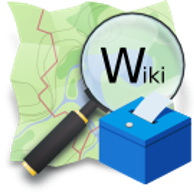
New proposal on the #OpenStreetMap Wiki for voting: Markers indication proposal. It introduces an indication:* prefix so marker nodes can state what they refer to (e.g., indication:man_made=pipeline, indication:emergency=fire_hydrant), even when the hidden feature isn’t mapped. 📍🛠️
It also updates the replacement for pipeline=marker and deprecates utility=hydrant in favor of utility=water + indication:emergency=fire_hydrant. 🧯💧
https://wiki.openstreetmap.org/wiki/Proposal:Markers_subject_refinement
When I copy coordinates in digiKam, it formats the coordinates like:
12,50266°E, 41,91712°N
But this format is not recognized by OSM, nor Google Maps. Does anyone know if it is possible to change the coordinates format in digiKam?
Are you interested in improving the mapping of bike infrastructure on @openstreetmap in your area? People for Bikes are hosting two webinars to show you how:
February 17, 12 PM MT: OpenStreetMap 101: Introduction to Bike Infrastructure Mapping in OpenStreetMap
Register now at https://peopleforbikes-org.zoom.us/meeting/register/wTzleGeQRs2R03Lyv9X62g#/registration
February 24, 12 PM MT: OpenStreetMap 201: Advanced Bike Infrastructure Mapping With JOSM
Register now at https://peopleforbikes-org.zoom.us/meeting/register/5JJQazNKTU-lcCptQCrucQ#/registration
@everton137 @okfn @wikimediafoundation @eloquence @bjoernsta @_elena Another project to get inspired from is #Openstreetmap, which continues to be an awesome worldwide collaboration of many people and organizations.
Der SEV in Leverkusen wegen der Generalsanierung sagt den Busfahrern sie sollen sich OSMAnd installieren und damit die Streckendateien öffnen.
Cool das #openstreetmap und opensource dafür genutzt wird.
@notjustbikes @duco what about OsmAnd? Based on #OpenStreetMap, has the ability also to import #gpx, to set a cycling-profile, is free, works on Android and iOS...
@notjustbikes explains why Google Maps is bad for cycling:
on YouTube: https://www.youtube.com/watch?v=csHdwHTteOw
on Nebula: https://nebula.tv/videos/notjustbikes-why-i-dont-use-google-maps-in-amsterdam
He recommends https://nl.routeplanner.fietsersbond.nl/ and https://www.fietsknoop.nl/fietsroute-planner for the Netherlands instead. The second is using #openstreetmap but I wished there would be a simple #OSM based app that works everywhere. Does someone have recommendations for Germany?
#di_day hasn't a recipe yet.

Een #OpenStreetMap :osm: -bijdrager schreef in het Nederlands 💬: "Trijn Rembrands."
🎋 Lees hun @openstreetmap dagboek in 👉🏼 https://www.openstreetmap.org/user/GerardHog/diary/408208.
Ich habe soeben die aktuelle Version der #OpenFietsMap vom 07. Februar in #QMapShack und auf meinem #Garmin installiert 🗺️ 🚲 😀
Nicht, dass ich die neueste Version bei diesem Wetter unbedingt brauchen würde, aber man weiß ja nie, wohin mich mein Fahrrad führt 😉
🔗 https://www.openfietsmap.nl/downloads/germany
#Rad #Fahrrad #Bike #Radtour #Navigation #Navi #OpenStreetMap #OFM

Ça fait 2 semaines qu'une mairie est en train de signaler une modification de son plan de circulation aux gestionnaires de GPS.
Nous ( #OpenStreetMap ) n'existons pas à l'évidence...
Ce n'est pas comme si le site web de la commune utilisait des cartes OSM interactives
Fatigué de cette inculture numérique institutionnelle


Ein :osm: #OpenStreetMap mitwirkender schrieb auf Deutsch 💬: "Laufende Projekte."
🎋 Lesen sie das @openstreetmap tagebuch 👉🏼 https://www.openstreetmap.org/user/silversurfer83/diary/408204.
29 people made 939 changes yesterday to #OpenStreetMap using https://mapcomplete.org
@brodersen.dk@bsky.app answered 376 questions with the thematic map etymology
lunar_jaws812 answered 189 questions with the thematic maps benches, advertising, etymology and healthcare
Toto2642 added 13 points, answered 59 questions and moved a point with the thematic map surveillance


Carapanantuba, Amapá parece que precisa de mapeamento!
População: 190
Contagem de edificações: 0
Link do mapa: https://www.openstreetmap.org/#map=16/0.1891718/-50.85566
#OpenStreetMap

Joussard, Alberta seems like it could use some mapping!
Population: 600
Building count: 4
Map link: https://www.openstreetmap.org/#map=16/55.397884/-115.95234
#OpenStreetMap

Theodosia, Missouri seems like it could use some mapping!
Population: 254
Building count: 1
Roads to review: 25
Map link: https://www.openstreetmap.org/#map=16/36.58284/-92.676
#OpenStreetMap

Dans cette rue à double sens, il y a une bande cyclable uniquement dans le sens de la montée (du bas à gauche vers le haut à droite).
Cette bande cyclable est très bien matérialisée (goudron en couleur).
Est-ce qu'elle est à gauche parce qu'on se repère par rapport aux petits triangle ?