#HeavyRain

2026-02-13

Storm set to pummel L.A. with heavy rains, flooding and beach hazards

Southern California is experiencing the calm before the storm. Forecasters say a strong system is headed our way…
#NewsBeep #News #Topstories #area #beachhazard #flooding #forecaster #gustywind #Headlines #heavyrain #heavyrainfall #meterologist #monday #nationalweatherservice #ryankittell #southerncalifornia #storm #TopStories #tuesday #wednesday
newsbeep.com/394877/

2026-02-11

Forschungsprojekt #heavyRAIN erfolgreich abgeschlossen. Mit Technologie made-in-Bochum #Starkregen früher erkennen:

okeanos.ai/downloads/heavyRAIN

#okeanos

‘It’s rained every day this year’: South Wales soaked as January hits 156% of normal rainfall

New Met Office figures show Swansea, Carmarthenshire and Pembrokeshire were among the UK’s wettest regions in January, recording 156% of the long‑term average rainfall.

The relentless downpours have left the ground saturated, meaning even modest showers are now causing flooding, travel disruption and difficult driving conditions.

A yellow weather warning for rain is in force, with forecasters expecting 20–30mm widely and more than 50mm over higher ground.

‘Rain reported somewhere in the region every day’

Met Office spokesman Stephen Dixon said the south‑west of England and southern Wales had seen a “very wet start to the year”.

“Rain has been reported somewhere in the region every day of the year so far,” he said, adding that a succession of Atlantic fronts in mid‑January turned an otherwise average month into one that was 50% wetter than normal.

January’s rainfall made it the 12th wettest on record for the region.

The Met Office says rainfall was a defining feature of January 2026. The UK recorded 117% of its long‑term average rainfall for January, but this figure masks striking regional differences. Some areas experienced exceptional rainfall totals, while others remained relatively dry.

Why it’s been so relentlessly wet

Met Office science manager Dr Amy Doherty said the UK has been stuck under a persistent Atlantic pattern, with a strong jet stream repeatedly firing low‑pressure systems into southern Britain.

“With little opportunity for drier conditions in between, the ground has become saturated,” she said. “Even moderate rainfall has had a greater impact.”

The jet stream — which normally sits further north at this time of year — has shifted south, funnelling storm systems into Wales while trapping colder air to the north. The result is a “battleground” pattern of repeated rain bands, occasional hill snow, and very few dry spells.

More rain on the way

Forecasters say the unsettled theme will continue into the weekend and next week.

  • Thursday–Friday: Heavy, persistent rain pushing north, with a risk of surface water flooding.
  • Saturday: Frequent showers, especially across South Wales, with brief brighter spells in the west.
  • Sunday: Slightly drier for some, but yet another band of rain arriving from the south and west.
  • Next week: Low pressure remains in charge, with further spells of rain and only a hint of colder air later in the week.

Met Office operational meteorologist Dan Stroud said: “Unfortunately, there’s no end in sight.”

Warnings in place

Yellow warnings cover parts of Wales, southwest and southeast England and the West Midlands, with the Met Office warning of flooding of a few homes and businesses, difficult driving conditions, longer journey times and possible power interruptions.

A brief break? Not yet

While computer models show a small chance of a colder, drier northerly flow developing late next week, the Met Office says this is an “outlier”. Most forecasts keep Wales in the same pattern: unsettled, cloudy, and repeatedly wet.

For now, the message is simple: keep the waterproofs handy — the rain isn’t going anywhere.

#flooding #heavyRain #MetOffice #persistentRain #rain #rainfall #weather
Two people walk along a rain‑soaked Swansea promenade under umbrellas, with sandbags lining the path and grey skies overhead.Met Office rainfall map for January 2026

Storm Chandra to hit South West Wales with severe winds and heavy rain

The region has barely recovered from Storm Ingrid, which brought heavy rain, strong winds and flooding risks only days ago. Earlier in the month, Storm Goretti split South West Wales with amber and yellow warnings, delivering thundersnow, travel disruption and power cuts across parts of the country. In December, Storm Bram brought further rain and wind alerts, leaving the ground sodden heading into the new year.

Now Storm Chandra is set to add more pressure. A deep Atlantic low will sweep into Pembrokeshire, Carmarthenshire and Swansea Bay later today, with the Met Office issuing a Yellow wind warning for the region. Gusts strong enough to disrupt travel and affect coastal communities are expected through Monday night and into Tuesday.

Storm Names for 2025 and 2026
(Met Office)

Met Office Chief Forecaster, Paul Gundersen, said:

“Southwest Wales remains vulnerable after recent storms, and Storm Chandra will bring another spell of strong winds and heavy rain. With the ground already saturated, even moderate rainfall could lead to disruption.”

Forecasters warn that even moderate rainfall could cause problems as it falls on saturated land. Surface water flooding is possible on roads across Swansea, Neath Port Talbot, Carmarthenshire and Pembrokeshire, particularly during the Tuesday morning commute.

Strong winds are also a concern. Exposed coastal areas of Pembrokeshire and Carmarthenshire could see gusts approaching 70 to 80mph, while inland areas including Swansea and Llanelli are likely to experience blustery conditions throughout Tuesday.

The Environment Agency has warned of significant surface water flooding in the southwest of England, with a risk of river flooding developing on Tuesday. While the most severe impacts are expected across the border, Welsh communities are being advised to remain alert.

Chris Wilding, Flood Duty Manager at the Environment Agency, said:

“Storm Chandra is likely to bring significant surface water flooding in the southwest, and river flooding could follow. Just 30cm of flowing water is enough to float a car, so people should avoid driving through floodwater.”

Residents in flood‑prone parts of South West Wales are being encouraged to prepare a flood kit, including insurance documents, warm clothing, bottled water, a torch and essential medicines.

A spokesperson for the Met Office, said:
“It’s important people stay up to date with the latest warnings. Conditions will vary quickly as Chandra moves through, and the combination of wind, rain and saturated ground could make travel difficult.”

Storm Chandra is the next named storm on the western Europe list shared between the UK, Ireland and the Netherlands.

The unsettled weather is expected to continue through the week, though Wednesday may bring a brief window of drier and brighter conditions for parts of Wales before further rain returns from the west.

#flooding #heavyRain #MetOffice #Storm #StrongWind #YellowWeatherWarning
Met Office map highlighting Yellow and Amber rain warnings across South West Wales, Devon and Cornwall, with major cities and motorways labelled.Storm Names for 2025 and 2026

Storm Ingrid set to batter South West Wales with heavy rain, strong winds and flooding risk

Yellow warnings in place for South Wales

The Met Office has issued Yellow weather warnings for rain across South Wales, including Carmarthenshire, Pembrokeshire, Swansea and Neath Port Talbot, as Storm Ingrid brings another spell of wet and windy weather to the region.

Forecasters say the storm — named by the Portuguese national weather service — will sweep in from the southwest early on Friday, with conditions expected to worsen through the day and into Saturday morning.

Met Office radar showing bands of heavy rain and strong winds moving across South West Wales as Storm Ingrid approaches. Image: Met Office.

“Potential for disruption” across the region

Met Office Chief Forecaster Neil Armstrong said the system could cause problems even though rainfall totals in Wales won’t reach the extreme levels expected in parts of Scotland.

“While rainfall totals in Northern Ireland, south Wales and parts of the southwest of England won’t reach those that we’ll see in parts of Scotland, there’s still a potential for some disruption, particularly for travel.”

The Met Office says the warnings highlight the risk of fast‑flowing or deep floodwater, difficult driving conditions and the possibility of some communities being temporarily cut off.

⚠️ Yellow weather warning issued ⚠️

Rain & wind across southern parts of Wales and southwest England

Friday 02:00 – Saturday 09:00

Latest info 👉 https://t.co/QwDLMfRBfs

Stay #WeatherAware⚠️ pic.twitter.com/Rg8eJViQVy

— Met Office (@metoffice) January 22, 2026

Heavy rain falling on already saturated ground

Storm Ingrid is expected to bring more than 20mm of rain for some areas, falling on ground already soaked by weeks of unsettled weather. Forecasters warn that even modest rainfall could lead to surface flooding, swollen rivers and blocked routes.

Along the coast, large waves and strong gusts are likely, with winds of 45–50mph inland and peaks of up to 60mph possible in exposed areas.

Friday looks worst for South West Wales

The Met Office says the worst of the weather for Wales will arrive on Friday, with rain pushing in from the southwest and lingering into Saturday morning before easing.

Scotland will continue to see the heaviest rainfall, with some high‑ground areas expected to exceed 100mm, but South West Wales remains firmly in the zone for disruption.

More unsettled weather to follow

Low pressure will continue to dominate through the weekend, bringing further spells of rain and wind. Looking ahead to next week, the Met Office says there is still uncertainty, but wintry conditions are possible in parts of the UK, especially further north and east.

#floodRisk #heavyRain #MetOffice #StormIngrid #StrongWind #YellowWeatherWarning
Met Office map highlighting a Yellow weather warning area across South West Wales.Met Office radar map showing rain and strong winds over South West Wales during Storm Ingrid.
Diego :mastodon:diegopds@bolha.us
2026-01-15

Quantic Dream Collection (4 jogos) por R$ 35,33 (86% Off) na Steam

Abaixo, preços dos jogos para comprar separadamente:

- Detroit: Become Human R$ 23,99 (80% Off);
- Beyond: Two Souls R$ 5,99 (90% Off);
- Heavy Rain R$ 5,99 (90% Off); e
- Fahrenheit: Indigo Profecy Remastered R$ 3,29 (90% Off).

Destes, testei apenas o Demo de Detroit: Become Human, tem uma ambientação puxada para o cyberpunk, lembrando jogos como Deus Ex e séries como Almost Human. Esses jogos, em geral, parecem muito bons e os preços excelentes. Só fica a ressalva de que são extremamente cinemáticos, soando mais como um filme interativo do que um jogo, às vezes.

store.steampowered.com/bundle/

#NaMinhaMaoEMaisBarato

@jogos

#QuanticDream #Steam #Games #QuanticDreamCollection #DetroitBecomeHuman #BeyondTwoSouls #HeavyRain #Fahrenheit #IndigoProfecy

2026-01-13

Almost 300 millimetres of rain on #VancouverIsland in three-day drenching

A number of communities in #BritishColumbia’s south coast have received more than 100 millimetres of rain in the atmospheric river event over the last three days, with one station reporting nearly 300 millimetres.

Jan. 13, 2026

VANCOUVER - "A number of communities in British Columbia’s south coast have received more than 100 millimetres of rain in the atmospheric river event over the last three days, with one station reporting nearly 300 millimetres.

#EnvironmentCanada says the #KennedyLake Forestry Station on Vancouver Island received a whopping 286 millimetres from Saturday to Monday.

"On the mainland, #PortMellon reported 204 millimetres.

"The weather agency says at least 20 weather stations in the region reported rain of more than 100 millimetres, including 168 millimetres in #Ucluelet.

"Other parts of Metro #Vancouver and the Lower Mainland were also drenched, with #Squamish reporting 132 millimetres.

"The #HeavyRain triggered several evacuation orders and alerts in areas including Chemainus Bridge and the Nanaimo Regional District on Vancouver Island, with one evacuation order for a single property near #ParksvilleBC.

"Much of B.C.‘s south coast and Vancouver Island remain under a flood watch, with a flood warning sill in effect for the Englishman River near Parksville.

"This report by The Canadian Press was first published Jan. 13, 2026."

Source:
thestar.com/news/canada/britis

#ExtremeWeather #ExtremeWx #ExtremeRain #ClimateChange #CanadianWx

Swansea escapes Storm Goretti snow – but Wales still hit by thundersnow, travel chaos and power cuts

While South West Wales’ main urban centres saw rain instead of the heavy snow forecast, conditions elsewhere deteriorated sharply, with parts of Pembrokeshire even experiencing rare thundersnow as schools shut, rail lines suspended, mountain roads closed and hundreds of homes left without power.

Mountain routes shut as blizzards hit higher ground

The Bwlch mountain road (A4107) was closed at 7pm on Thursday after conditions became unsafe. The joint decision by Neath Port Talbot, Bridgend and Rhondda Cynon Taf councils followed reports of drifting snow and falling temperatures. The route reopened shortly after 8am today.

Pembrokeshire saw some of the worst conditions, with heavy snow, sleet and strong winds creating hazardous driving on higher ground. The B4329 between Haverfordwest and Cardigan, which crosses the Preseli Hills, remained closed for long periods as blizzards hit the route.

Issues were also reported on the B4313 between Fishguard and Narberth, where drifting snow made conditions treacherous across the northern foothills.

Further south, the A478 from Clunderwen to Cardigan saw significant snow in places, with drivers warned to avoid higher ground as accumulations built up.

Council teams worked through the night to clear fallen trees, deal with surface water flooding and keep primary routes open.

Thundersnow caught on camera in Pembrokeshire

A dramatic burst of thundersnow was captured in Pembrokeshire overnight, with lightning illuminating heavy snowfall as Storm Goretti swept across the county.

Local resident Harvey Harbour filmed the moment and shared it on X, showing bright flashes lighting up the sky as snow fell across the area.

You can watch the video here:

Thundersnow!⚡❄️
Pembrokeshire
Never experienced anything like this…😰#uksnow #walesnow
#thundersnow #lightning#pembrokeshire #snow pic.twitter.com/OXONFBBzFM

— Harvey Harber (@HarberHarv7128) January 8, 2026

What is thundersnow?

Thundersnow is a rare weather phenomenon where a thunderstorm produces snow instead of rain.

It happens when a strong, unstable weather system forms above very cold air at ground level. The storm still generates lightning and thunder, but the precipitation falls as snow.

The lightning often appears brighter because it reflects off the snowflakes, while the thunder sounds quieter because the snow absorbs the sound.

Thundersnow can bring sudden heavy downpours of snow, reduced visibility and rapidly worsening road conditions.

Rail disruption continues across Wales

Transport for Wales services remain heavily affected, with suspensions and reduced timetables on several lines following snow, ice and fallen trees.

Routes impacted include:

  • Craven Arms to Swansea (Heart of Wales Line)
  • West of Carmarthen
  • Maesteg to Ebbw
  • Wrexham to Bidston
  • Llandudno Junction to Blaenau Ffestiniog

CrossCountry services between Cardiff and Birmingham are not running, and passengers are being urged to check before travelling.

Your earlier Swansea Bay News reporting highlighted “do not travel” warnings issued yesterday as rail operators shut lines ahead of the storm.

Schools shut and power cuts reported

Across Wales, at least 150 schools are closed today, with Powys, Blaenau Gwent and Wrexham among the worst affected.

Around 600 homes were without power this morning, with further outages reported in north and mid Wales. Pembrokeshire also saw power cuts around Clunderwen and Bridell, alongside burst water mains in Haverfordwest.

Emergency services across Ceredigion and Powys reported “numerous incidents” overnight, with police urging people to avoid all but essential travel.

Swansea spared – but warnings remain in force

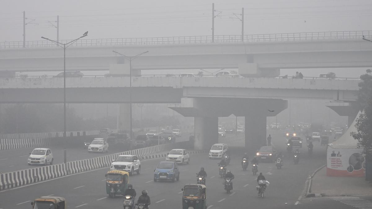
Despite fears of thundersnow and blizzard conditions reaching Swansea Bay, the city avoided the worst of the storm, with rain and sleet falling instead of snow.

However, Amber and Yellow warnings for snow, rain and wind remain in place across much of Wales, and forecasters say conditions may continue to change through the day.

Bridgend Council said all routes in the county borough remain open after crews dealt with fallen trees and blocked drains overnight.

What happens next

The Met Office says Storm Goretti remains a “multi‑hazard event”, with snow, strong winds and heavy rain still expected to bring disruption in parts of Wales.

Gusts of up to 70mph are forecast along the south coast, while higher ground in mid and north Wales may see further snow and ice as temperatures fluctuate.

Swansea Bay News will continue to update readers as the situation develops.

Related stories from Swansea Bay News

Storm Goretti: ‘Do not travel’ warning as rail lines shut and Wales braces for blizzard conditions
Rail operators issued severe travel warnings as Storm Goretti brought widespread disruption across Wales.

Storm Goretti: Amber and Yellow warnings split South West Wales as Met Office updates forecast
Updated Met Office alerts warned of snow, rain and strong winds across the region.

#AmberWeatherWarning #blizzard #BwlchMountain #featured #heavyRain #lightning #MetOffice #Pembrokeshire #PembrokeshireCountyCouncil #snow #StormGoretti #StrongWind #Swansea #SwanseaCouncil #thundersnow #walesnow #YellowWeatherWarning
Swansea Council gritting lorry spreading salt on a road during winter conditions.
Mohammed SibakhiMohammed78
2026-01-09

RE: mastodon.social/@Mohammed78/11

Yesterday, due to the strong winds and heavy rain, my children and I were flooded.
It was an extremely exhausting and difficult day.
We desperately need your support—any help or share could save us. 🙏🌧️

gofund.me/8346c1ef

2026-01-08

Juneau braces for another storm as state coordinates disaster assistance

Stan Hubbard and Caleb Hubbard shovel snow off the roof of First Bank in Juneau on Jan. 7,…
#NewsBeep #News #Headlines #Alaska #AlaskaDepartmentofTransportation #AtmosphericRiver #avalanche #disasterdeclaration #flooding #Gov.MikeDunleavy #heavyrain #Juneau #JuneauAssembly #nationalweatherservice #NicoleFerrin #PatDryer #RobertBarr #stateassistance #storm #UnitedStates #Us #USA #winterstorm
newsbeep.com/352180/

Storm Goretti: ‘Do Not Travel’ warning as rail lines shut and Wales braces for blizzard conditions

Digital boards at Cardiff Central are already flashing the message as Transport for Wales and Network Rail prepare to close multiple lines from 3pm today, with more disruption expected overnight.

It follows our earlier report revealing that amber and yellow Met Office warnings had been split across South West Wales, with forecasters warning of up to 30cm of snow, heavy rain in lower lying areas, 50mph winds and the risk of power cuts, fallen trees and dangerous road conditions.

Now the situation has escalated again.

Amber warning hits tonight — huge area affected

The Met Office’s amber warning for snow kicks in at 8pm tonight and runs until 9am Friday, covering a huge stretch of Wales including:

  • Carmarthenshire
  • Ceredigion
  • Conwy
  • Denbighshire
  • Gwynedd
  • Powys
  • Blaenau Gwent
  • Caerphilly
  • Merthyr Tydfil
  • Monmouthshire
  • Rhondda Cynon Taf
  • Torfaen
  • Wrexham

Forecasters say travel could become “very difficult or impossible”, with the risk of power outages, localised flooding, and roads blocked by snow and fallen trees.

A Transport for Wales train pushes through worsening snow as Storm Goretti disrupts services across Wales. (Image: TfW)

Rail chaos: lines shut, buses unlikely, and a skeleton timetable

TfW says trains will run normally this morning — but from 3pm, the network will be hit by widespread suspensions, including all services west of Carmarthen and the Heart of Wales Line.

Routes suspended from 3pm

  • Llandudno Junction to Llandudno
  • Llandudno Junction to Blaenau Ffestiniog
  • Wrexham to Bidston
  • Craven Arms to Swansea (Heart of Wales Line)
  • All services west of Carmarthen
  • Maesteg and Ebbw Vale lines
  • Vale of Glamorgan and Barry lines
  • Cardiff to Penarth

The Cambrian Coast line (Machynlleth–Pwllheli) is suspended all day.

Reduced timetable from 3pm

  • Carmarthen to Cardiff: 1 train per hour
  • Cardiff to Crewe: 1 train per hour
  • Shrewsbury to Holyhead: 1 train per hour
  • Shrewsbury to Aberystwyth: 1 train every 2 hours
  • Shrewsbury to Crewe (local): 1 train every 2 hours
  • Birmingham International to Shrewsbury:
  • Cardiff to Gloucester: 1 train per hour
  • Chester to Manchester: 1 train per hour

Core Valley Lines will run 1 train per hour between Treherbert, Merthyr, Rhymney and Cardiff, plus a half‑hourly Coryton–Cardiff Bay service.

A reduced timetable will run elsewhere, but TfW warns that rail replacement buses may not be possible because roads are already becoming treacherous.

Network Rail: “We may need to close more lines”

Network Rail says snow, sleet and freezing temperatures are already affecting points, signalling and track conditions — and more closures could follow as the storm intensifies.

Teams are out clearing drainage, checking point heaters, running snow‑treatment trains and positioning chainsaw crews to deal with fallen trees.

TfW: “Platforms will be slippery — take extra care”

TfW says passengers should expect severe delays, slippery platforms and last‑minute cancellations.

Tickets for today will be valid until Sunday.

Passengers should check:

Related stories from Swansea Bay News

Storm Goretti: Amber and yellow warnings split South West Wales as Met Office updates forecast
Forecasters warn of heavy snow, strong winds and dangerous travel conditions across the region.

Met Office warns more snow on the way as Storm Goretti hits Wales on Thursday
Further snow and ice expected as Storm Goretti moves in, bringing widespread disruption.

Must‑know winter road rules to avoid £2,500 fines
Drivers warned to follow key winter safety rules as severe weather sweeps across Wales.

#AmberWeatherWarning #cancelledTrains #heavyRain #NetworkRail #snow #StormGoretti #StrongWind #trains #TransportForWales #YellowWeatherWarning
Overhead view of a TfW train at Llanelli station with snow covering the ground.Front view of a TfW train surrounded by falling snow during Storm Goretti.

Storm Goretti: Amber and yellow warnings split South West Wales as Met Office updates forecast

While some communities face heavy rain, others are braced for significant snowfall, and higher ground could see amber‑level disruption as the storm moves in on Thursday night and into Friday.

The updated warnings come just 24 hours after Swansea Bay News’ original report, with forecasters now warning that Storm Goretti will be a “multi‑hazard event” bringing snow, strong winds and heavy rain.

Met Office Chief Forecaster Neil Armstrong said:

“Storm Goretti will be a multi-hazard event, with the most significant impacts from snow in parts of Wales and the Midlands, though rain and strong winds also have the potential to bring disruption to many.”

⚠️⚠️ Amber weather warning issued ⚠️⚠️

Snow across parts of England and Wales

Thursday 2000 – Friday 0900

Latest info 👉 https://t.co/QwDLMfRBfs

Stay #WeatherAware ⚠️ pic.twitter.com/E5uNBZR6wY

— Met Office (@metoffice) January 7, 2026

What’s now expected across South West Wales?

The Met Office’s latest update shows a patchwork of warnings across our area:

🌧️ Yellow warning – Heavy rain

Some coastal and low‑lying parts of Swansea, Neath Port Talbot and Carmarthenshire are now under a yellow rain warning, with the risk of localised flooding and difficult driving conditions.

❄️ Yellow warning – Snow

Higher ground inland — including parts of the Swansea and Neath valleys, the Amman Valley and northern Carmarthenshire — are covered by a yellow snow warning, with several centimetres possible.

🟧 Amber warning – Snow

The most serious alert now affects parts of mid and north Carmarthenshire and the Brecon Beacons, where 15–25cm of snow is possible, and up to 30cm on the highest routes.

This is expected to cause significant travel disruption, especially overnight Thursday into Friday morning.

Neil Armstrong added:

“Accumulations of 5–10 cm are likely widely, with 15–25 cm in some places, especially hills, and perhaps up to 30 cm very locally.”

Strong winds also expected

Although the strongest winds will hit the Channel Islands and northern France, Storm Goretti will still bring gusts of 50–60mph to parts of Wales, especially exposed coasts and hills.

Travel disruption likely

The Met Office warns that:

  • Roads may become impassable in amber snow areas
  • Bus and train services could face delays or cancellations
  • Rain may cause surface water flooding in low‑lying areas
  • Icy conditions are likely overnight

The RAC is urging drivers to think carefully before travelling.

RAC spokesperson Alice Simpson said:

“In the areas worst affected by Storm Goretti, drivers need to be considering if it’s safe to get behind the wheel.”

What happens after Storm Goretti?

The storm is expected to move eastwards by Friday evening, giving way to a brief calmer spell on Saturday. But forecasters warn that Sunday and Monday are highly uncertain, with the possibility of further widespread snowfall as milder Atlantic air clashes with the cold air currently over the UK.

Deputy Chief Forecaster Mark Sidaway said:

“This set up brings a risk of some further widespread snowfall, so it’s important to stay aware of the forecast and any warnings which may be issued.”

#AmberWeatherWarning #featured #heavyRain #MetOffice #snow #weatherWarning #WeatherAware #YellowWeatherWarning
Snow‑filled rural lane in South Wales with deep snow covering the road and surrounding hedgerows. Image credited to 4x4 Response South Wales.
2025-12-22

2nd #AtmosphericRiver to flood #California with firehose of rain into Christmas

#HeavyRain and #flooding problems experienced in the #Northwest in recent weeks from atmospheric rivers will shift farther south into California through Christmas Day with major travel disruptions and safety concerns.

By Alex Sosnowski, AccuWeather senior meteorologist

Published Dec 21, 2025

"Two main atmospheric rivers will force copious amounts of #Pacific moisture into #California this week. Heavy rain with incidents of flooding, washouts and mudslides will expand and shift from north to south over the state, leading to travel disruptions at the very least and posing some risk to lives and property in extreme cases. The #SierraNevada will receive many feet of snow as freezing levels lower through the week and the region is affected by both atmospheric rivers.

"The storms are hitting at a busy time of the year, with many traveling short and long distances, running errands and planning outdoor activities.

"The first atmospheric river was already in progress and will continue to focus on Northern to Central California into Wednesday. A second atmospheric river is forecast to develop and concentrate on Central and Southern California from Tuesday night through Christmas Day. But even beyond Christmas, lingering moisture will lead to additional rounds of showers and mountain snow, according to AccuWeather.

"Through Wednesday, much of the #Sacramento Valley and the #SanFrancisco Bay region will receive 2-4 inches of rain with locally higher amounts. The anticipated rainfall for San Francisco in the stormy pattern into next weekend will bring from one to two times the historical average for December.

"On the west- and southwest-facing mountainsides of the Coast Ranges and the Sierra Nevada, 4-12 inches of rain will pour down with an AccuWeather Local StormMax™ of 20 inches.

"At times, multiple inches of rain can fall in a matter of hours, overwhelming storm drains and causing small streams and short rivers to quickly overflow their banks. As the ground becomes saturated, the risk of debris flows, road washouts and hillside collapses will increase substantially.

"From Tuesday night to early Friday, the second atmospheric river will spray rain of varying intensity throughout Central and Southern California.

"A general 4-6 inches of rain is forecast to fall on the Los Angeles basin. Downtown, L.A. had seven times its historical average monthly rainfall for November with 5.53 inches. While no rain has fallen so far in L.A. this month, from two to three times December's average rainfall of 2.48 inches may occur with the stormy pattern from Tuesday to Saturday.

"On the southwest-facing hillsides of the Transverse Ranges, 6-12 inches will pour down with an AccuWeather Local StormMax™ of 16 inches. Even in many desert areas of Southeastern California, between 0.25 of an inch to 1 inch of rain is expected to fall.

"Just as with the first atmospheric river up north, rain will be drenching, leading to rapid urban flooding and flooding of small streams and short-run rivers, along with mudslides, washouts and the potential for hillside slides in Southern California. "

Source:
accuweather.com/en/severe-weat

#ClimateChange #AtmosphericRivers #ExtremeWeather #ExtremeRain #Landslides #Flooding #ExtremeWx

2025-12-21

Good evening guys. One last thing before I head to bed. I’ve just been outside checking on how things are going. You know how the saying goes that frogs will always find the higher ground in a flood. Guess what I have on the little back area lawn that was awash earlier. Frogs 🐸!Well 4 of them anyway. So I guess that means I can classify my home as higher ground 😁 🐸 🐸 🐸. G’nite 🛌. #Flooding #HeavyRain #FreakinScary!

2025-12-20

UAE Storms Disrupt Flights, Flood Roads As Heavy Rain Batters Region

UAE Storms Disrupt Flights, Flood Roads As Heavy Rain Batters Region --------------------------------------------------------------------------------------------------------- OdishaTV is Odisha's no 1 News Channel. OTV being the first private satellite TV channel in Odisha carries the onus of charting a course that behoves its…

odnews.in/uae-storms-disrupt-f

2025-12-18

Thoothukudi: Water Birds Gather In Salt Pans Amid Heavy Rain

Thoothukudi: Water Birds Gather In Salt Pans Amid Heavy Rain --------------------------------------------------------------------------------------------------------- OdishaTV is Odisha's no 1 News Channel. OTV being the first private satellite TV channel in Odisha carries the onus of charting a course that behoves its pioneering efforts. Accordingly its…

odnews.in/thoothukudi-water-bi

2025-12-17

Leaving Kakariko Village At The Wrong Moment Makes Hyrule Go Crazy
Wow, Ocarina of Time has some bizarre glitches. There is one where if you talk to a character with a specific object in hand, you get absolutely the wrong item in return. I need to pin down the details so I'll talk about that one later.

In the meantime, he
setsideb.com/leaving-kakariko-
#niche #retro #glitch #HeavyRain #niche #ocarinaoftime #retro #Skawo #zelda

The State Signalthestatesignal
2025-12-16

Israeli forces launched attacks on Gaza Strip on Tuesday Dec. 16, as Palestinians face harsh conditions due to heavy rains which have flooded Al-Shifa Hospital and swept away tents. thestatesignal.com/israeli-arm

Another amber alert: South West Wales braced for torrential rain on Monday

The Met Office says up to 200mm of rain could fall in parts of Wales and Cumbria over 48 hours, with Swansea, Neath Port Talbot, Carmarthenshire and Pembrokeshire all sitting squarely in the amber zone.

And it’s not the first time. South West Wales has already endured three Amber warnings and five Yellow warnings in the past month alone – a relentless barrage of alerts that’s left roads saturated, rivers swollen and communities braced for more disruption.

The warning kicks in Monday morning, with heavy rain expected to lash the region throughout the day. Roads including the A40, A48, A465 and M4 are likely to be affected, and drivers are being urged to plan ahead.

“A slow-moving weather front stretching into the tropical Atlantic will continue to bring adverse conditions,” said Met Office Chief Meteorologist Paul Gundersen.

The Environment Agency has also sounded the alarm, warning of possible surface water flooding and urging drivers not to take risks.

“Just 30cm of flowing water is enough to float your car,” said Flood Duty Manager Jonathan Day. “Don’t drive through flood water — it’s often deeper than it looks.”

While the south of England stays dry and bright, Wales is once again in the firing line. The amber warning follows a string of recent alerts, with saturated ground and swollen rivers increasing the risk of disruption.

Looking ahead, Tuesday may bring a brief break in the rain — but forecasters say another Atlantic low is already lining up for Wednesday, bringing more wet and windy weather to western Britain.

Related stories from Swansea Bay News

Amber weather warning issued for South Wales as heavy rain forecast
Met Office warns of flooding and travel disruption as rain lashes the region.

Storm Bram set to batter South West Wales with rain and wind alerts
Yellow and amber warnings issued as storm conditions hit Swansea and Neath Port Talbot.

South Wales braces for floods as amber warning upgraded
Natural Resources Wales urges residents to prepare for flooding and landslides.

Cwmbwrla Roundabout closed again as floodwaters rise under amber warning
Key Swansea route shut as floodwaters surge during latest amber alert.

More flood alerts →
Browse the latest flood warnings and updates across South West Wales.

#AmberWeatherWarning #Carmarthenshire #floodAlerts #heavyRain #MetOffice #NeathPortTalbot #Pembrokeshire #Swansea #weatherWarning #YellowWeatherWarning

Amber rain warning issued for South West Wales on Monday, with up to 200mm forecast and flooding risks expected across Swansea, Neath Port Talbot, Carmarthenshire and Pembrokeshire.

Client Info

Server: https://mastodon.social
Version: 2025.07
Repository: https://github.com/cyevgeniy/lmst